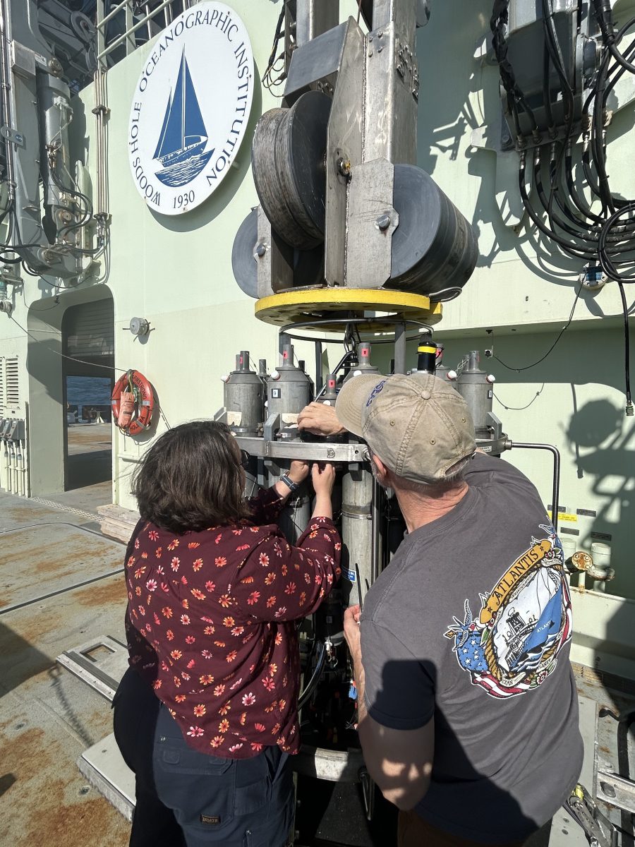
Melissa Sanderson, chief operating officer at Fishermen’s Alliance, (left) attaching a Lowell Instruments prototype CTD to the rosette onboard the R/V Neil Armstrong (Credit: Noelle Olsen)
By Melissa Sanderson
We’re on the cusp of a new era in collaborative research—an era where data is also helping fishermen make day-to-day decisions about where and when to fish, allowing them to be more efficient and help them adapt in the face of a rapidly changing ocean.
People refer to this new chapter as environmental intelligence – meant to supplement stacks of logbooks most fishermen use to plan their year. We also need to use fishermen’s experiences and environmental intelligence at the policy table to reimagine fisheries management in a more dynamic ocean.
This quest for environmental intelligence is why I found myself spending six days at sea last month as part of a Woods Hole Oceanographic Institution (WHOI) research cruise aboard the R/V Neil Armstrong. For a thalassophile, there is nothing better than being at sea, and perhaps nothing so impressive as being at sea on a 235-foot oceanographic research vessel when you’re used to 40-foot fishing vessels.
My priority was to share what we were observing each day, serve as liaison between the scientists on-board and the fishing community. I also ended up being the morning watch lead and helped deploy research equipment for eight hours a day.
As a last-minute addition, I brought along Lowell Instruments’ prototype CTD to compare against WHOI’s equipment. Funded by the Massachusetts Technology Collaborative Innovation Institute, CTDs are designed to be attached to fishing gear for the season, passively collecting conductivity (salinity), temperature, and depth with the data automatically flowing into the eMOLT program.
The science team was led by WHOI physical oceanographer Glen Gawarkiewicz, who is part of WHOI’s Fishery Futures Alliance, a collaboration to help fishermen adapt to a rapidly changing ecosystem by leveraging the latest technologies, real-time data, and climate models at WHOI.
The research technology available on the Neil Armstrong is amazing and reflective of the cutting-edge technology available at WHOI. Check out the photo gallery to learn more about the research tools we used on the cruise.
The primary research objective was to map currents, temperature, salinity, and acoustic backscatter (a proxy for marine life) associated with a streamer of cooler, fresher nearshore water being drawn offshore to the east of a small, older warm core ring. Warm core rings bring warm salty Gulf Stream water onto the continental shelf. Streamers are difficult to observe from satellite thermal imagery, so going to sea is the best way to better understand them, and maybe their impacts on marine life.
This cruise was adaptive; we had a general plan for each day but details of where and when we sampled could be amended in real time based on findings and feedback from fishermen.
Here are a few preliminary observations from the cruise:
- A major surprise was that all stations extending as far south as 39° 30’ N, where it was 1000+ fathoms deep, had a thick surface layer of fresher nearshore water typical of much shallower areas (25 fathoms). We were expecting to see saltier Gulf Stream water in these deep areas over the warm core ring.
- Surface temperatures were close to normal for this time of year.
- Bottom temperatures over the outer continental shelf were quite cold: 43 to 45 °F. This is good because it means the cold pool is present. There have been concerns in the last several years that the cold pool was disappearing, and its loss could negatively impact spawning, recruitment, and upwelling of nutrients available to the food web.
- The continental shelf water extended further offshore than usual, to 60 fathoms deep; normally it only makes it to 45 to 50 fathoms.
- The streamer of shelf water was headed to the southwest, offshore, at 70° 45’ W at 0.8 knots. It brought colder, fresher water offshore.
For more than two decades I’ve been connecting fishermen and scientists to improve the data available to fisheries management, but this WHOI research cruise was a first! Over the years, collaborative research projects have resulted in changes in how we define reproducing populations of cod (stock structure), how much quota a fisherman is charged when he throws back an undersized fish, and which areas are open to fishing (special access, exempted fishing permits, and scallop rotation).
These traditional projects are still important, but with help from partners in the science community and elsewhere, we will be expanding the scope of collaborative research to increase the region’s environmental intelligence, providing fishermen with tools to help adapt to a rapidly changing ocean.
We’re lucky to be partnering with WHOI on many of these new projects, including the Fisheries Future Alliance. Stay tuned over the coming year as we dive into environmental intelligence!